
Sunday 21st April 2024

Today's weekly takes approx. 11 minutes to read.
Hi {{ first name | }}👋
We’re delighted to be back with a new ‘Hidden Scotland Weekly’. We really hope that you enjoy reading.
As always we welcome you to provide feedback, you can find this at the bottom of the email.
Have a great Sunday!
What’s in this week’s email.
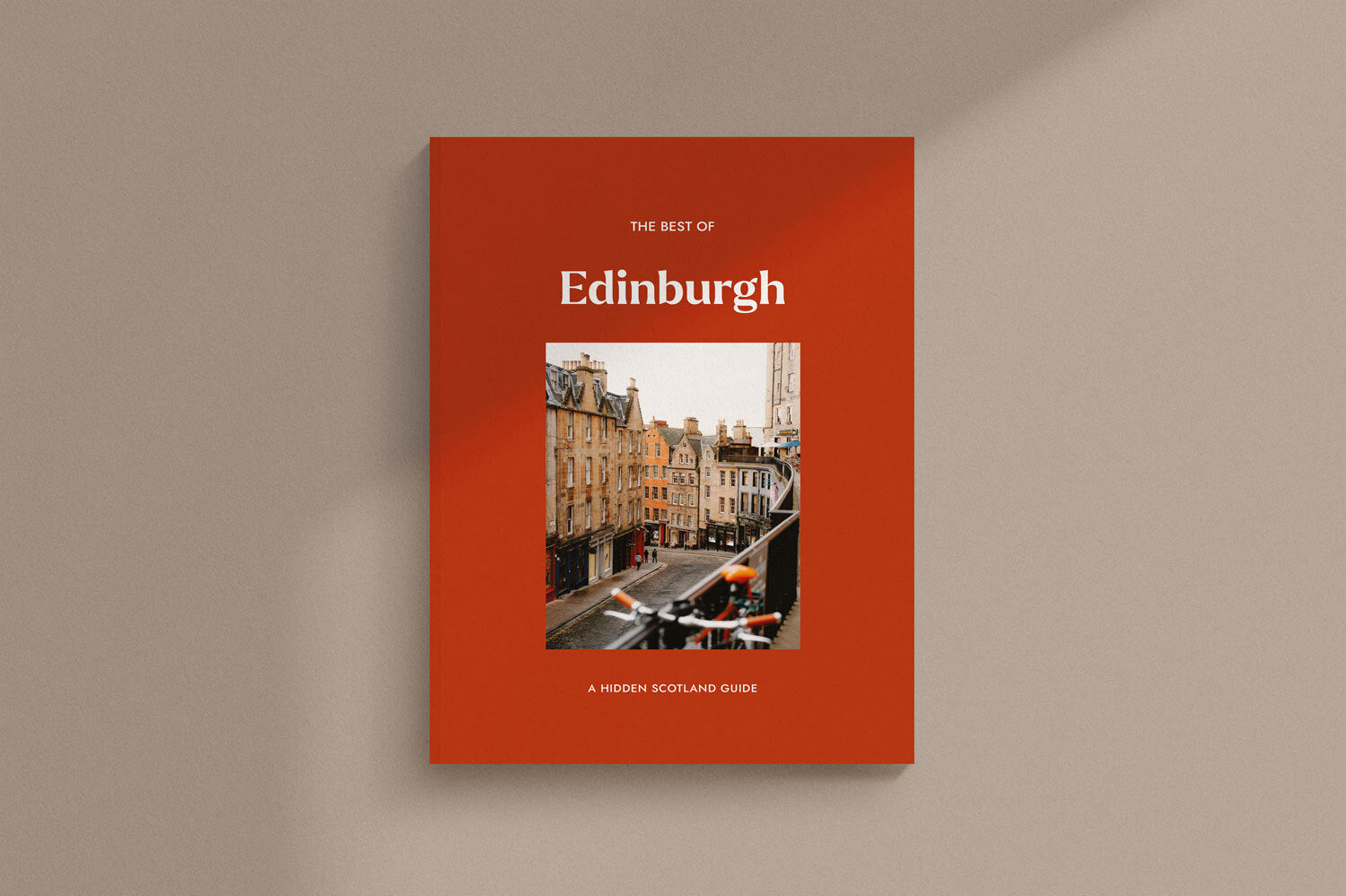
Issue 08 has launched
This Week’s Quiz
The Battle of Glenlivet
Did You Know
Bealach na Bà - The Road That Winds Through Time
A Trip Through Time
Quiz Answers
Free Wallpaper

IT’S HERE!
We now have the eighth edition of Hidden Scotland magazine in our hands, and as ever we are beyond delighted with how it has turned out. Thanks to everyone who has ordered this issue, we couldn’t be happier with how it has turned out. We still have copies available, find out more below.

1.What year was the Battle of Bannockburn?
2.Which clan was tasked by the King of Scots with guarding Urquhart Castle?
3.In what century was Rosslyn Chapel built?

The Battle of Glenlivet
In the late 16th century, Scotland was in the midst of a violent struggle and great religious strife between the old Catholic order and the emerging Protestant regime. By 1594 laws restricting the Catholic faith were introduced by King James VI and it seemed inevitable that bloodshed would soon follow.
Influential nobles from right across the Northeast gathered behind the Earls of Huntly and Errol ready to oppose the King. In response, a large army loyal to James and led by the Earl of Argyll travelled north into the Highlands to deal with the rebel force. As one side marched through Badenoch and Strathspey, the other moved west from Aberdeenshire. The meeting point would be Moray and the result was the almost completely forgotten Battle of Glenlivet.
The King’s force was an impressive 10,000 men strong, however, it was made up mostly of untrained militia and with the 19-year-old Argyll in charge, they lacked real experience. Huntly had only managed to raise 2000 for his rising so the loyal soldiers were feeling confident against this much smaller force.
That’s why Huntly did the last thing anybody expected, he rushed to attack. The rebels gambled that Argyll and his inexperienced men fighting far from home would panic at the first sight of action. They used their cavalry to quickly advance up the hill, while powerful field artillery blasted over their heads in support.
That enormous gamble paid off when huge swathes of Argyll’s army abandoned the field without even striking a single blow. The men who remained behind fought back hard and Huntly himself was almost killed when his horse was shot out from beneath him. A few hours later, the King’s army had suffered an embarrassing defeat, with young Argyll allegedly being led weeping from the field.
The rebels may have won the day, but all they had really achieved was a little time. Soon, King James himself led another royal army north to deal with the problem personally and he was a much tougher prospect. Both the Earls of Huntly and Errol had little choice but to flee the country and pray for their salvation.
Words by Graeme Johncock

Did you know that mysterious coffins were once found on Arthur’s Seat?
In June 1836, a group of young boys hunting rabbits on the slopes of Arthur’s Seat found more than they had bargained for. Hidden in a little crevice, they discovered 17 miniature coffins laid out in rows, each with a carved figure inside. Nobody knows who made the coffins or why these figurines were placed in the hillside, but some believe they represented sailors lost at sea or were used in some form of witchcraft. Many fingers point towards the infamous serial killers Burke and Hare who may have carved each figure to represent the bodies of those sold to the medical school.

Bealach na Bà - The Road That Winds Through Time
"Although the road has been engineered by a series of zig zags to ease the gradient as much as possible, nevertheless it is terribly steep, and the surface is wretched."
Guidebook describing Bealach na Bà, 1898
Not all country roads are created equal. Some glide between pancake-flat fields. Others curve easily across rolling farmland. Others have to buck, twist and swivel their way through the mountains, contorting themselves in spaghetti twirls and presenting drivers with a challenge that’s not so much a highway as a kind of asphalt-covered bobsleigh run. Bealach na Bà, as you may be aware, falls into this last category.
The road is a legendary one. Wriggling up from sea level to an altitude of 626m, it stands as the third highest road in Scotland and arguably the most eulogised stretch of carriageway in the country. It’s around 9km long and is still considered to be Britain’s steepest road. You’ll find it on the savagely beautiful Applecross peninsula, amid the romping highlands of Wester Ross, and if you’re in any doubt as to its reputation, consider the sign at the top, which includes the following words: “Gradients of 1 in 5 and hairpin bends. Not advised for learner drivers, very large vehicles or caravans.”
Next year will officially mark two centuries since the road’s construction, although the history of this winding, precipitous route dates back much longer. Hardy locals are thought to have forged a footpath up and over the hills as long as 2,000 years ago. Early Christian missionaries followed the same route on their way to and from a monastic settlement at Applecross, and the track later became a droving path for farmers herding their livestock to market at Muir of Ord. Indeed, the name Bealach na Bà translates as ‘Pass of the Cattle’, and we can only speculate as to the number of beasts that had to haul their bovine backsides up these energy-sapping slopes.
It was in the early years of the 19th century, however, when the road took proper shape. At the time, local landowners the Mackenzies were among those helping to push forward a road-building programme in the Highlands, in a bid to make the region more readily accessible. For obvious reasons, Bealach na Bà presented a headache, but having searched high and low to find a contractor willing to embark on what was a mammoth engineering conundrum – and splitting the cost with the government – a deal to begin work was finally signed on 4th May, 1818.
It’s said that the first contractor lasted only three months before being sent insane by the challenge of the task, not to mention the peril of falling rocks and boulders. The job was completed by John Reid & Son, an Edinburgh firm who took on the project at a cost of £4,000 (around half a million pounds in today’s money). Their labourers were on a shilling a day, and the landowners provided not only oatmeal – carb-heavy fuel being essential on a job like this – but rock-blasting materials and a horse and cart.
The road was completed by April 1822. Originally covered in rough gravel, it incorporated several hairpin bends and seemed to meander madly across the map, but it also proved a practical way of connecting the residents of Applecross to the wider world. It was not, however, without its flaws. After snow – and remember the word takes on a special potency in this part of the UK – it could leave the road impassable for weeks, buried under head-high drifts. When this happened, access to and from the peninsula was limited to the steamer service that puffed across to Kyle of Lochalsh and the Isle of Lewis.

Only in the 1950s did the road receive a serious upgrade. Between 1956 and 1958, its surface was levelled, tarmac was applied and its switchback bends were widened. To ease matters further – and no doubt to the jubilation of regular drivers – a series of passing places for cars were installed at semi-regular intervals. The mind boggles when imagining the kind of manoeuvres that would previously have had to be employed when vehicles met each other head-on.
There’s one thing, however, that every incarnation of this snaking singletrack road has had in common: the view. Stretching east towards Raasay and west towards Loch Kishorn, the panorama in both directions is an exquisite one: high-sided and summit-strewn, blending the wild greens of the land with the steely blues of the coast. It’s even been named one of the most picturesque drives on the planet, drawing comparison with the great mountain passes of the Alps.
Little wonder that so many see the road, which sits along the North Coast 500 circuit, as a rite of passage. Fleets of high-spec cars – not to mention motorcyclists and generously thighed road-bikers – regularly wind up and down its curves. If you’re tempted to join them, be aware that this is a memorable but genuinely challenging drive. Reversing along narrow, steep inclines may well be required, and the route becomes extra-hazardous in snowy, foggy or icy conditions. It would be deeply unwise to attempt it at any time in a campervan or motorhome, while novice drivers would always be best to steer clear. Literally.
On which note, you might be relieved to hear it’s not the only way onto this ravishing peninsula. The singletrack coastal road coming in from the north offers a more sedate, but no less scenic, way to reach Applecross, with glorious views out towards Torridon and Skye. Once you’ve arrived, meanwhile, you could do far worse than call in at the waterside Applecross Inn, a fixture here since the 1950s and rightly extolled in the Good Pub Guide for its “particularly friendly welcome, real ales and good seafood.” Which is what precisely what you’d hope for in this neck of the woods – no matter which road you’ve come in on.

Words by Ben Lerwill and taken from Issue 03 of the Hidden Scotland Magazine

Dunnottar Castle - Taken by Simon Hird


On the 23rd April 1733 – The impressive Tay Bridge at Aberfeldy is begun by General Wade
On the 24th April 1558 – Mary Queen of Scots marries the future Francis II of France
Quiz Answers
1314
Clan Grant
15th Century